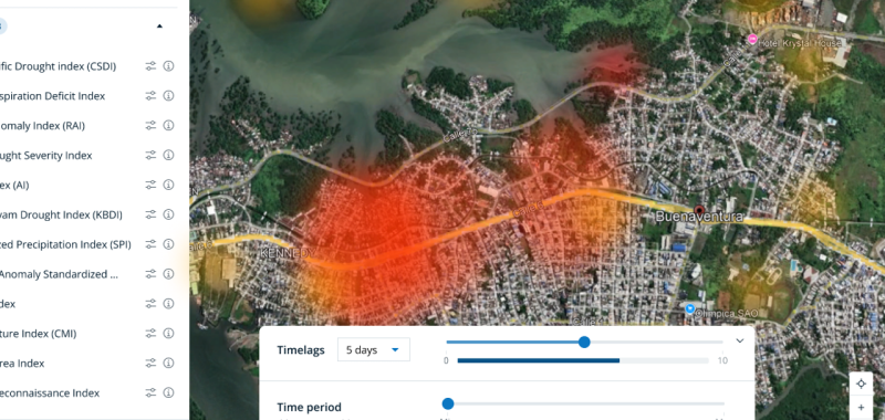
GeoTar is WFP’s next‑generation, AI‑enabled geospatial targeting and vulnerability analysis system, relaunched in 2025 to transform how WFP identifies which communities are most vulnerable and where support is needed most. It integrates food security data, climate patterns, market prices, displacement trends and satellite imagery and turns them into detailed maps. These high‑resolution maps (down to 1 km² or smaller) show important differences within districts that normal reports often miss. GeoTar is designed for staff in WFP country offices, regional bureaux and headquarters, helping teams make faster, clearer and more evidence‑based decisions, even when data is limited or situations change quickly.
The system pulls all relevant data into one place and uses machine learning to automatically produce updated vulnerability layers. These layers help WFP decide where to target assistance, set priorities and allocate resources more effectively. Tasks that previously took weeks of manual work can now be done in hours.
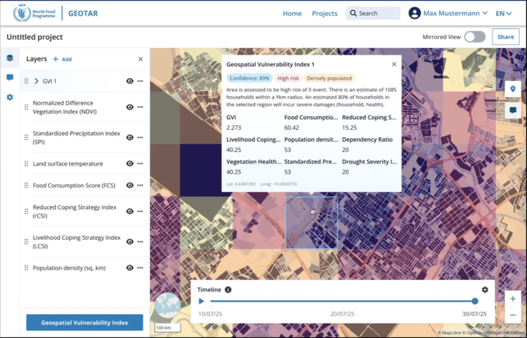
GeoTar stands out because it shows detailed patterns and “hotspots” within districts that other tools overlook. It doesn’t rely on static assessments. Instead, it combines many data sources with predictive modelling, making decisions more consistent, transparent and timely. It also helps reduce mistakes, such as leaving out people who need assistance or including those who don’t.
Built to be enterprise‑ready, GeoTar integrates seamlessly with WFP systems and is designed to scale and work across many countries.