When disasters strike, responders need quick and reliable information on which buildings and areas have been affected to guide lifesaving decisions. Today, damage assessments often depend on manual interpretation of satellite imagery or weather‑dependent optical images, resulting in delays, limited coverage, and inconsistent accuracy. These constraints slow down emergency response and hinder timely support to communities in crisis.
Project overview
The Building Damage Assessment (BDA) initiative introduces an AI‑powered, all‑weather damage assessment system that uses radar imagery to rapidly map destruction across vast areas, even when clouds or darkness make traditional methods impossible. Built on self‑supervised learning and designed to generalize across countries, it delivers fast, reliable insights that help emergency teams act sooner and with greater confidence.
The challenge
The solution
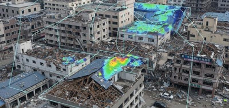
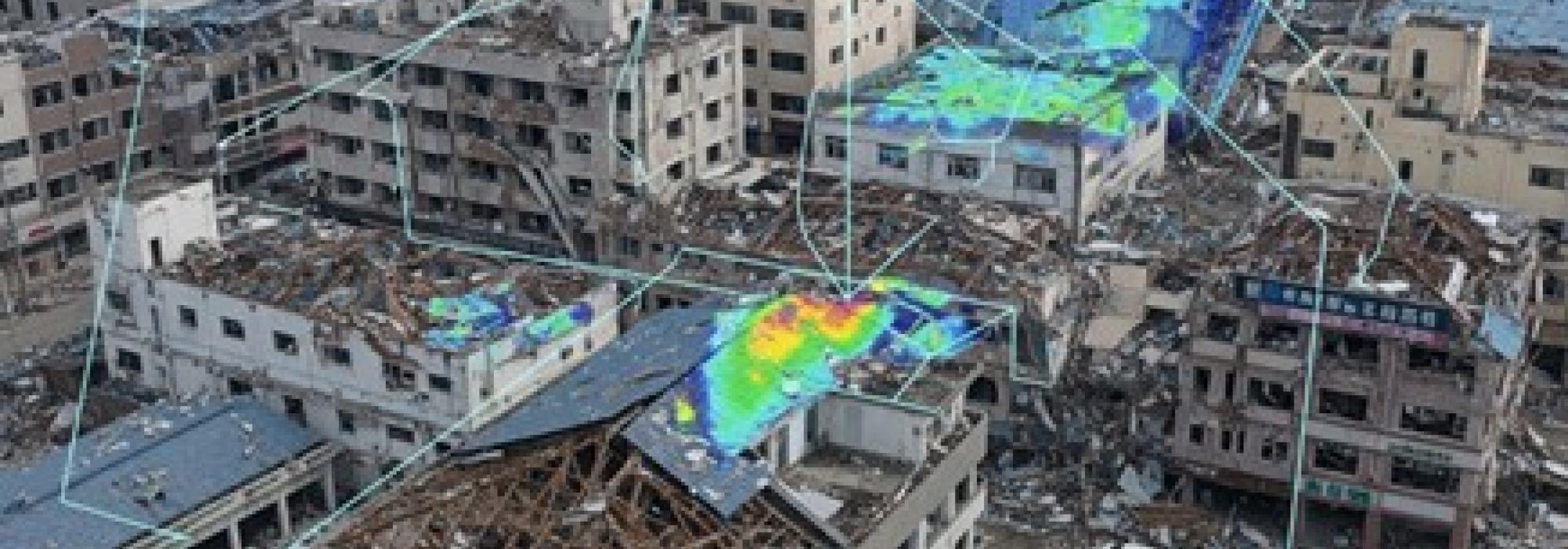
The Building Damage Assessment (BDA) initiative combines radar (SAR) and optical satellite imagery with advanced AI models to rapidly detect changes and identify damaged infrastructure, even in cloudy conditions or hard‑to‑access areas. AI‑based multimodal change‑detection models provide fast, scalable, and more robust assessments, enabling responders to prioritize areas, allocate resources, and act with greater confidence in the critical first hours after a disaster.
Results
The new damage‑assessment model scans crisis areas up to 64,000 km2 in just over two minutes, giving teams an near-immediate view of where destruction is most severe. In major emergencies, like the Türkiye earthquake in 2023, the system has accurately identified damaged areas with nearly 90 percent accuracy, helping responders quickly prioritize hardest‑hit communities so lifesaving assistance arrives faster when time is critical. These capabilities mean responders can prioritize the hardest‑hit communities sooner, helping lifesaving assistance reach people when they need it most.
Last updated:
13/04/2026